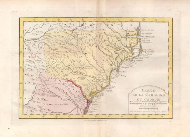
Title:
“Carte de la Caroline et Georgie”
Map Maker:
Jacques Nicolas Bellin
Delicately engraved map of the colonies of Carolin... (full text available to subscribers)
| Item Detail |
| |
| |
MapMaker: |
Jacques Nicolas Bellin
|
|
| |
| |
Subject: |
Colonial Southeast |
|
| |
Period/Size: |
1773 / 7.3" x 11.0" (18.6 x 28.0 cm)
|
|
| |
Color: |
Colored
|
|
| |
Condition: |
(+B) Nice original color with a couple of faint spots and a light crease. (condition help) |
|
| |
Source: |
Raynal's Atlas Portatiff |
|
| |
References: |
cf Cummings (SE) #311; cf Sellers & van Ee #1384. |
|
| |
|
|
| Sales Information |
| |
| |
Price: |
|
|
| |
| |
Offered by: |
Old World Auctions |
|
| |
Catalog: |
Auction No. 125 - Antique Maps, Charts, Atlases & Globes (654) |
|
| |
Lot/Item #: |
190 |
|
| |
| |
Date: |
09/2008
|
|
| |
| |
|
Antique Maps - Valuation and Pricing, Descriptions, Resources |
|
Home |
Information |
Search |
Register |
Contact Us |
Site Map
Americana Exchange, Inc. © 1999 - 2024 Americana Exchange, Inc.. All rights reserved.
OldMaps.com, the OldMaps.com logo and
AMPR are service marks or registered service marks of Americana Exchange, Inc..
|