Title:
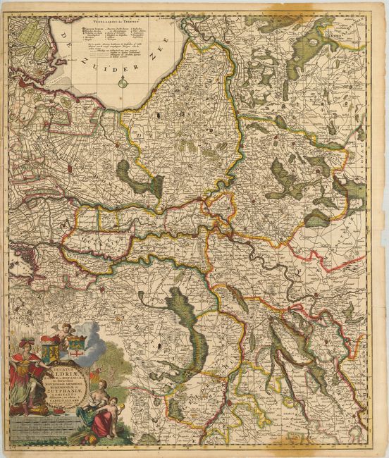
“Ducatus Geldriae Batavae et Hispanicae, in Tetrarchias Noviomagi, Arnhemii, Ruremondae & Zutphaniae…”
Map Maker:
Carel Allard
This is a very scarce and detailed map of Gelderla... (full text available to subscribers)
| Item Detail |
| |
| |
MapMaker: |
Carel Allard
|
|
| |
| |
Subject: |
Netherlands |
|
| |
Period/Size: |
1700 / 23.3" x 19.5" (59.2 x 49.6 cm)
|
|
| |
Color: |
Colored
|
|
| |
Condition: |
(+C) Nice impression and original color. There are a couple of stains and some tears entering the map (some with old paper repairs on verso). The left side margin is narrow (1/8") as issued and there is a large worm hole in the border near the cartouche (condition help) |
|
| |
Source: |
|
|
| |
References: |
|
|
| |
|
|
| Sales Information |
| |
| |
Price: |
|
|
| |
| |
Offered by: |
Old World Auctions |
|
| |
Catalog: |
Auction No. 125 - Antique Maps, Charts, Atlases & Globes (654) |
|
| |
Lot/Item #: |
526 |
|
| |
| |
Date: |
09/2008
|
|
| |
| |
|
Antique Maps - Valuation and Pricing, Descriptions, Resources |
|
Home |
Information |
Search |
Register |
Contact Us |
Site Map
Americana Exchange, Inc. © 1999 - 2024 Americana Exchange, Inc.. All rights reserved.
OldMaps.com, the OldMaps.com logo and
AMPR are service marks or registered service marks of Americana Exchange, Inc..
|