| Item Detail |
| |
| |
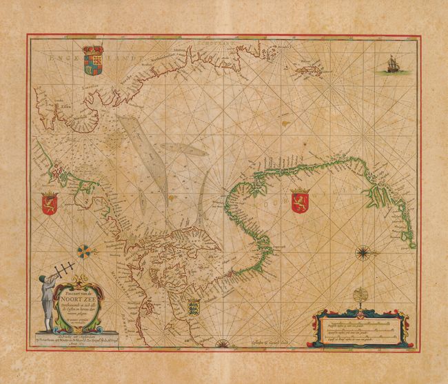
MapMaker: |
Pieter Goos
|
|
| |
| |
Subject: |
North Sea |
|
| |
Period/Size: |
1669 / 17.5" x 22.0" (44.5 x 55.9 cm)
|
|
| |
Color: |
Colored
|
|
| |
Condition: |
(+B) This map is printed on thick paper with exceptional original color highlighted with gold leaf. The paper is toned with some scattered foxing, but the quality of the color more than makes up for the foxing. (condition help) |
|
| |
Source: |
De Zee-Atlas, Ofte Water-Weereld… |
|
| |
References: |
Tooley (MCC-70) #290; Putnam, Early Sea Charts, pp. 99-100. |
|
| |
|
|
| Sales Information |
| |
| |
Price: |
|
|
| |
| |
Offered by: |
Old World Auctions |
|
| |
Catalog: |
Auction No. 125 - Antique Maps, Charts, Atlases & Globes (654) |
|
| |
Lot/Item #: |
492 |
|
| |
| |
Date: |
09/2008
|
|
| |
| |
|