Title:
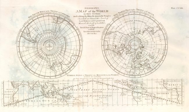
“Geography. A Map of the World in Three Sections Describing the Polar Regions to the Tropics in which are traced the Tracts of Lord Mulgrave and Captain Cook”
Map Maker:
Constantine John Phipps
A finely engraved double polar projection, with a ... (full text available to subscribers)
| Item Detail |
| |
| |
MapMaker: |
Constantine John Phipps
|
|
| |
| |
Subject: |
World - Polar |
|
| |
Period/Size: |
1776 / 9.0" x 16.5" (22.9 x 42.0 cm)
|
|
| |
Color: |
Black & White
|
|
| |
Condition: |
(+B) Issued folding, now pressed flat. Small, light area of foxing at lower center and some very light mold stains at upper left. Printed on fine hand laid paper with original margins. (condition help) |
|
| |
Source: |
Voyage toward the North Pole |
|
| |
References: |
|
|
| |
|
|
| Sales Information |
| |
| |
Price: |
|
|
| |
| |
Offered by: |
Old World Auctions |
|
| |
Catalog: |
Auction No. 125 - Antique Maps, Charts, Atlases & Globes (654) |
|
| |
Lot/Item #: |
049 |
|
| |
| |
Date: |
09/2008
|
|
| |
| |
|
Antique Maps - Valuation and Pricing, Descriptions, Resources |
|
Home |
Information |
Search |
Register |
Contact Us |
Site Map
Americana Exchange, Inc. © 1999 - 2024 Americana Exchange, Inc.. All rights reserved.
OldMaps.com, the OldMaps.com logo and
AMPR are service marks or registered service marks of Americana Exchange, Inc..
|