Rister or Sign In to see pricing information


Title:

Carte Reduite des Mers du Nord

Map Maker:

Jacques Nicolas Bellin

Carte Reduite des Mers du Nord

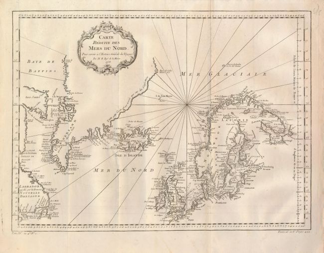
This nice chart is centered roughly on Iceland and... (full text available to subscribers)
Item Detail
 
  MapMaker:  

Jacques Nicolas Bellin


  Subject:  North Atlantic and Arctic Ocean  
  Period/Size:  1758 / 13.0" x 17.7"  (33.1 x 45.0 cm)  
  Color:  Black & White  
  Condition:  (A) Issued folding, with a bit of offsetting along one fold that can easily be erased. (condition help)  
  Source:  Prevost's Histoire Generale des Voyages  
  References:   
 
 
Sales Information
 
  Price: 

Please register your email to view records, or sign in with email address to see records


  Offered by:  Old World Auctions  
  Catalog:  Auction No. 125 - Antique Maps, Charts, Atlases & Globes (654)  
  Lot/Item #:  430  
 
  Date:  09/2008  


Antique Maps - Valuation and Pricing, Descriptions, Resources


Home | Information | Search | Register | Contact Us | Site Map

Americana Exchange, Inc. © 1999 - 2024 Americana Exchange, Inc.. All rights reserved. OldMaps.com, the OldMaps.com logo and
AMPR are service marks or registered service marks of Americana Exchange, Inc..