Title:
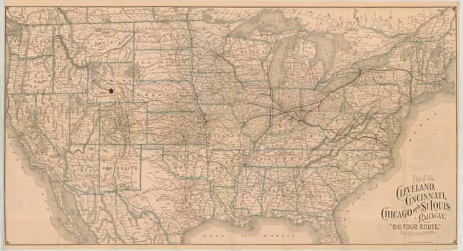
“Map of the Cleveland, Cincinnati, Chicago and St. Louis Railway. Big Four Route and Connections”
Map Maker:
Poole Brothers
Folding map with timetables and bird's eye view of... (full text available to subscribers)
| Item Detail |
| |
| |
MapMaker: |
Poole Brothers
|
|
| |
| |
Subject: |
United States |
|
| |
Period/Size: |
1890 / 16.0" x 30.5" (40.7 x 77.5 cm)
|
|
| |
Color: |
Colored
|
|
| |
Condition: |
(A) Folding, as issued. This example is mint save for a 1/4" ink spot in central Wyoming and owner's sign on back cover. (condition help) |
|
| |
Source: |
|
|
| |
References: |
|
|
| |
|
|
| Sales Information |
| |
| |
Price: |
|
|
| |
| |
Offered by: |
Old World Auctions |
|
| |
Catalog: |
Auction No. 125 - Antique Maps, Charts, Atlases & Globes (654) |
|
| |
Lot/Item #: |
154 |
|
| |
| |
Date: |
09/2008
|
|
| |
| |
|
Antique Maps - Valuation and Pricing, Descriptions, Resources |
|
Home |
Information |
Search |
Register |
Contact Us |
Site Map
Americana Exchange, Inc. © 1999 - 2024 Americana Exchange, Inc.. All rights reserved.
OldMaps.com, the OldMaps.com logo and
AMPR are service marks or registered service marks of Americana Exchange, Inc..
|