Title:
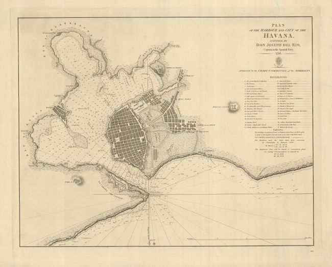
“Plan of the Harbour and City of the Havana, Surveyed by Don Joseph del Rio, Captain in the Spanish Navy”
Map Maker:
British Admiralty
This fine, scarce chart is the English version of ... (full text available to subscribers)
| Item Detail |
| |
| |
MapMaker: |
British Admiralty
|
|
| |
| |
Subject: |
Cuba, Havana |
|
| |
Period/Size: |
1844 / 16.0" x 20.8" (40.7 x 52.9 cm)
|
|
| |
Color: |
Black & White
|
|
| |
Condition: |
(+B) There are a couple of repaired tears, one of which enters 1" into the map in the key (it appears more as a crease than a tear). (condition help) |
|
| |
Source: |
|
|
| |
References: |
Cueto #189. |
|
| |
|
|
| Sales Information |
| |
| |
Price: |
|
|
| |
| |
Offered by: |
Old World Auctions |
|
| |
Catalog: |
Auction No. 125 - Antique Maps, Charts, Atlases & Globes (654) |
|
| |
Lot/Item #: |
366 |
|
| |
| |
Date: |
09/2008
|
|
| |
| |
|
Antique Maps - Valuation and Pricing, Descriptions, Resources |
|
Home |
Information |
Search |
Register |
Contact Us |
Site Map
Americana Exchange, Inc. © 1999 - 2024 Americana Exchange, Inc.. All rights reserved.
OldMaps.com, the OldMaps.com logo and
AMPR are service marks or registered service marks of Americana Exchange, Inc..
|