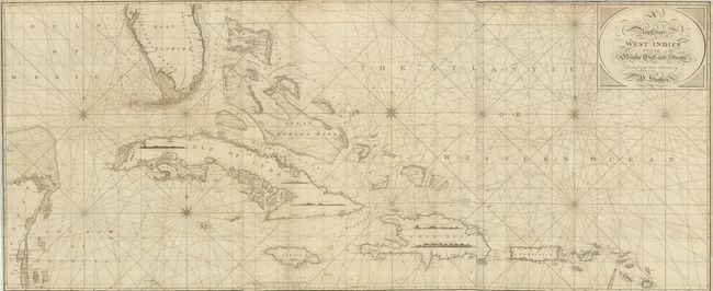
Title:
“A New Chart of the West Indies Including the Florida Gulf and Stream…”
Map Maker:
William Heather
This is an incredible, large-scale chart covering ... (full text available to subscribers)
| Item Detail |
| |
| |
MapMaker: |
William Heather
|
|
| |
| |
Subject: |
Caribbean |
|
| |
Period/Size: |
1797 / 30.8" x 73.5" (78.3 x 186.7 cm)
|
|
| |
Color: |
Black & White
|
|
| |
Condition: |
(B) The map is in remarkable condition considering it size and purpose. There are some repaired fold intersections and repairs in margins and the map borders, but there are no significant flaws. (condition help) |
|
| |
Source: |
A Marine Atlas |
|
| |
References: |
|
|
| |
|
|
| Sales Information |
| |
| |
Price: |
|
|
| |
| |
Offered by: |
Old World Auctions |
|
| |
Catalog: |
Auction No. 125 - Antique Maps, Charts, Atlases & Globes (654) |
|
| |
Lot/Item #: |
356 |
|
| |
| |
Date: |
09/2008
|
|
| |
| |
|
Antique Maps - Valuation and Pricing, Descriptions, Resources |
|
Home |
Information |
Search |
Register |
Contact Us |
Site Map
Americana Exchange, Inc. © 1999 - 2024 Americana Exchange, Inc.. All rights reserved.
OldMaps.com, the OldMaps.com logo and
AMPR are service marks or registered service marks of Americana Exchange, Inc..
|