Rister or Sign In to see pricing information


Title:

Map of a Part of Washington Territory to Accompany the Report of the Surveyor General

Map Maker:

U.S. Government

Map of a Part of Washington Territory to Accompany the Report of the Surveyor General

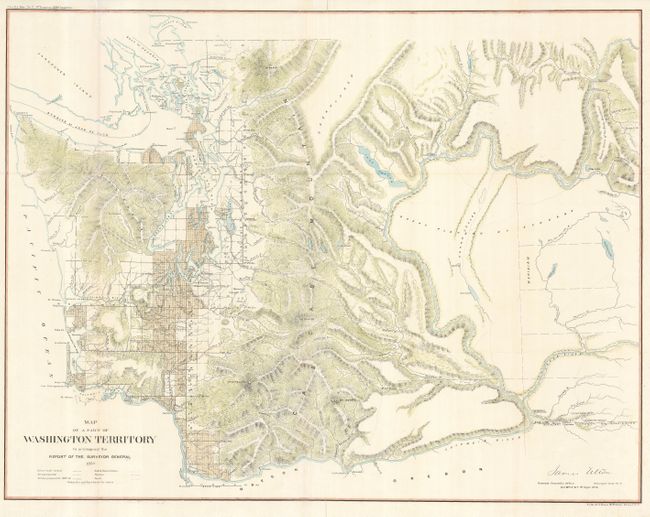
This is an early and uncommon map of Washington Te... (full text available to subscribers)
Item Detail
 
  MapMaker:  

U.S. Government


  Subject:  Washington  
  Period/Size:  1859 / 22.0" x 28.0"  (55.9 x 71.2 cm)  
  Color:  Colored  
  Condition:  (+B) Originally folded, now flattened with folds reinforced with tissue on verso. (condition help)  
  Source:  Senate Ex. Doc No. 2, 1st Session, 36th Congress  
  References:   
 
 
Sales Information
 
  Price: 

Please register your email to view records, or sign in with email address to see records


  Offered by:  Old World Auctions  
  Catalog:  Auction No. 125 - Antique Maps, Charts, Atlases & Globes (654)  
  Lot/Item #:  324  
 
  Date:  09/2008  


Antique Maps - Valuation and Pricing, Descriptions, Resources


Home | Information | Search | Register | Contact Us | Site Map

Americana Exchange, Inc. © 1999 - 2024 Americana Exchange, Inc.. All rights reserved. OldMaps.com, the OldMaps.com logo and
AMPR are service marks or registered service marks of Americana Exchange, Inc..