| Item Detail |
| |
| |
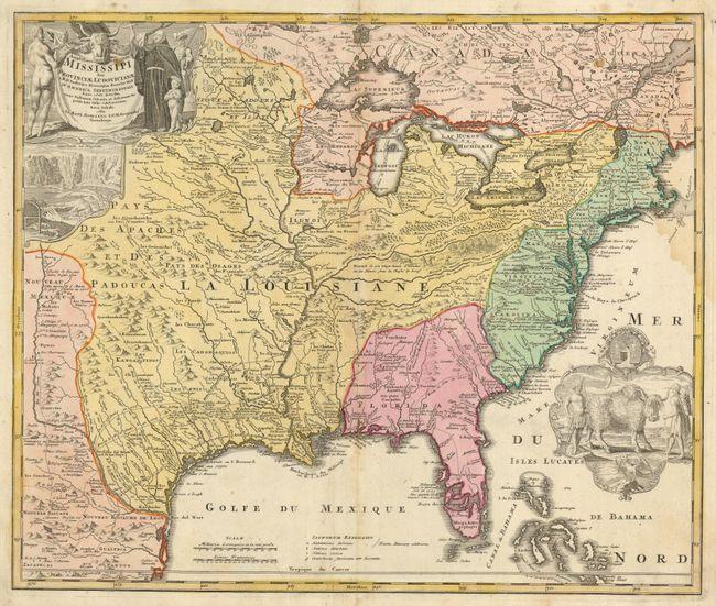
MapMaker: |
Johann Baptist Homann
|
|
| |
| |
Subject: |
Colonial North America |
|
| |
Period/Size: |
1730 / 19.3" x 22.8" (49.1 x 58.0 cm)
|
|
| |
Color: |
Colored
|
|
| |
Condition: |
(B) Nice original color. There is a spot in the title, a minor damp stain at right, and a bit of toning along centerfold. (condition help) |
|
| |
Source: |
|
|
| |
References: |
Cumming (SE) #170; Goss (NA) #49. |
|
| |
|
|
| Sales Information |
| |
| |
Price: |
|
|
| |
| |
Offered by: |
Old World Auctions |
|
| |
Catalog: |
Auction No. 125 - Antique Maps, Charts, Atlases & Globes (654) |
|
| |
Lot/Item #: |
114 |
|
| |
| |
Date: |
09/2008
|
|
| |
| |
|