| Item Detail |
| |
| |
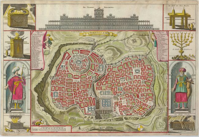
MapMaker: |
Bastiaan Stoopendaal
|
|
| |
| |
Subject: |
Holy Land, Jerusalem |
|
| |
Period/Size: |
1653 / 12.0" x 17.8" (30.5 x 45.3 cm)
|
|
| |
Color: |
Colored
|
|
| |
Condition: |
(+B) Issued folding, now flattened with some small fold separations reinforced on the verso with tissue, one entering the map at bottom about a half an inch. There are a few small spots on the map. (condition help) |
|
| |
Source: |
|
|
| |
References: |
Poortman & Augusteijn #143 (KII2); cf Laor #1150. |
|
| |
|
|
| Sales Information |
| |
| |
Price: |
|
|
| |
| |
Offered by: |
Old World Auctions |
|
| |
Catalog: |
Auction No. 125 - Antique Maps, Charts, Atlases & Globes (654) |
|
| |
Lot/Item #: |
734 |
|
| |
| |
Date: |
09/2008
|
|
| |
| |
|