Title:
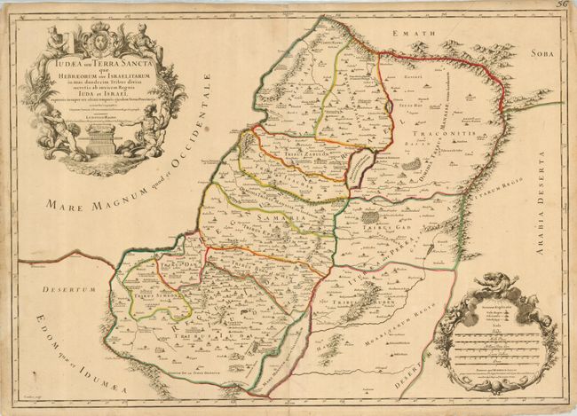
“Iudaea seu Terra Sancta quae Hebraeorum sive Israelitarum…”
Map Maker:
Sanson/Jaillot
Fine, decorative map of the kingdoms of Judea and ... (full text available to subscribers)
| Item Detail |
| |
| |
MapMaker: |
Sanson/Jaillot
|
|
| |
| |
Subject: |
Holy Land |
|
| |
Period/Size: |
1709 / 18.0" x 25.5" (45.8 x 64.8 cm)
|
|
| |
Color: |
Colored
|
|
| |
Condition: |
(+B) Original outline color. The paper is lightly toned with a couple of small spots and an extraneous crease along the centerfold. There is a separation of the bottom centerfold that enter the border and a couple of short edge tears, not affecting the (condition help) |
|
| |
Source: |
|
|
| |
References: |
Laor #369. |
|
| |
|
|
| Sales Information |
| |
| |
Price: |
|
|
| |
| |
Offered by: |
Old World Auctions |
|
| |
Catalog: |
Auction No. 125 - Antique Maps, Charts, Atlases & Globes (654) |
|
| |
Lot/Item #: |
725 |
|
| |
| |
Date: |
09/2008
|
|
| |
| |
|
Antique Maps - Valuation and Pricing, Descriptions, Resources |
|
Home |
Information |
Search |
Register |
Contact Us |
Site Map
Americana Exchange, Inc. © 1999 - 2024 Americana Exchange, Inc.. All rights reserved.
OldMaps.com, the OldMaps.com logo and
AMPR are service marks or registered service marks of Americana Exchange, Inc..
|