Rister or Sign In to see pricing information


Title:

An accurate Map of New Hampshire in New England, from a late Survey

Map Maker:

Anonymous

An accurate Map of New Hampshire in New England, from a late Survey

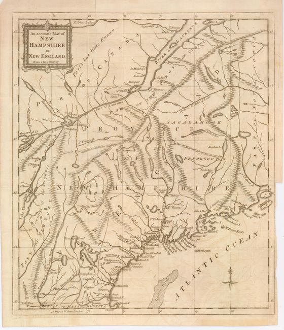
This Revolutionary War-era map covers the r... (full text available to subscribers)
Item Detail
 
  MapMaker:  

Anonymous


  Subject:  New England  
  Period/Size:  1781 / 12.7" x 11.2"  (32.3 x 28.5 cm)  
  Color:  Black & White  
  Condition:  (+B) There is slight offsetting and a binding tear in the border and tight binding trim at lower right. (condition help)  
  Source:  Universal Magazine  
  References:  Jolly UNIV-191; Seller and Van Ee #872.  
 
 
Sales Information
 
  Price: 

Please register your email to view records, or sign in with email address to see records


  Offered by:  Old World Auctions  
  Catalog:  Auction No. 125 - Antique Maps, Charts, Atlases & Globes (654)  
  Lot/Item #:  172  
 
  Date:  09/2008  


Antique Maps - Valuation and Pricing, Descriptions, Resources


Home | Information | Search | Register | Contact Us | Site Map

Americana Exchange, Inc. © 1999 - 2024 Americana Exchange, Inc.. All rights reserved. OldMaps.com, the OldMaps.com logo and
AMPR are service marks or registered service marks of Americana Exchange, Inc..