Title:
“Soil Map Dukes and Nantucket Counties Massachusetts”
Map Maker:
U.S. Government
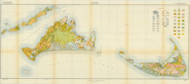
This large, colorful map details Martha's Vineyard... (full text available to subscribers)
| Item Detail |
| |
| |
MapMaker: |
U.S. Government
|
|
| |
| |
Subject: |
Massachusetts |
|
| |
Period/Size: |
1825 / 21.0" x 52.5" (53.4 x 133.4 cm)
|
|
| |
Color: |
Colored
|
|
| |
Condition: |
(A) The map is near fine less some light toning along folds. (condition help) |
|
| |
Source: |
Soil Survey of Dukes and Nantucket Counties, Mass. By W.J. Latimer |
|
| |
References: |
|
|
| |
|
|
| Sales Information |
| |
| |
Price: |
|
|
| |
| |
Offered by: |
Old World Auctions |
|
| |
Catalog: |
Auction No. 126 - Antique Maps, Charts, Atlases & Globes (655) |
|
| |
Lot/Item #: |
295 |
|
| |
| |
Date: |
12/2008
|
|
| |
| |
|
Antique Maps - Valuation and Pricing, Descriptions, Resources |
|
Home |
Information |
Search |
Register |
Contact Us |
Site Map
Americana Exchange, Inc. © 1999 - 2024 Americana Exchange, Inc.. All rights reserved.
OldMaps.com, the OldMaps.com logo and
AMPR are service marks or registered service marks of Americana Exchange, Inc..
|