| Item Detail |
| |
| |
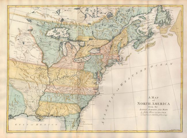
MapMaker: |
John Blair
|
|
| |
| |
Subject: |
Colonial United States and Canada |
|
| |
Period/Size: |
1768 / 16.0" x 22.0" (40.7 x 55.9 cm)
|
|
| |
Color: |
Colored
|
|
| |
Condition: |
(A) This beautiful example is fine less a small amount of centerfold toning at top and bottom mostly in blank margins. Crisp, early impression and full hand coloring on a superb sheet of hand laid paper with original margins. Two large watermarks. (condition help) |
|
| |
Source: |
Chronology and History of the World |
|
| |
References: |
McCorkle #768.2. |
|
| |
|
|
| Sales Information |
| |
| |
Price: |
|
|
| |
| |
Offered by: |
Old World Auctions |
|
| |
Catalog: |
Auction No. 126 - Antique Maps, Charts, Atlases & Globes (655) |
|
| |
Lot/Item #: |
125 |
|
| |
| |
Date: |
12/2008
|
|
| |
| |
|