Title:
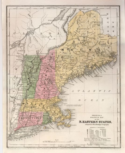
“Physical & Political Map of the N. Eastern States, adapted to Woodbridge's Geography”
Map Maker:
William Channing Woodbridge
This very nicely colored map includes the states o... (full text available to subscribers)
| Item Detail |
| |
| |
MapMaker: |
William Channing Woodbridge
|
|
| |
| |
Subject: |
New England |
|
| |
Period/Size: |
1843 / 10.6" x 8.6" (27.0 x 21.9 cm)
|
|
| |
Color: |
Colored
|
|
| |
Condition: |
(A+) Fine color and very nice impression. (condition help) |
|
| |
Source: |
|
|
| |
References: |
|
|
| |
|
|
| Sales Information |
| |
| |
Price: |
|
|
| |
| |
Offered by: |
Old World Auctions |
|
| |
Catalog: |
Auction No. 126 - Antique Maps, Charts, Atlases & Globes (655) |
|
| |
Lot/Item #: |
167 |
|
| |
| |
Date: |
12/2008
|
|
| |
| |
|
Antique Maps - Valuation and Pricing, Descriptions, Resources |
|
Home |
Information |
Search |
Register |
Contact Us |
Site Map
Americana Exchange, Inc. © 1999 - 2024 Americana Exchange, Inc.. All rights reserved.
OldMaps.com, the OldMaps.com logo and
AMPR are service marks or registered service marks of Americana Exchange, Inc..
|