Rister or Sign In to see pricing information


Title:

An Authentic Plan of the River St. Laurence, from Sillery to the Falls of Montmorency.

Map Maker:

John Gibson

An Authentic Plan of the River St. Laurence, from Sillery to the Falls of Montmorency.

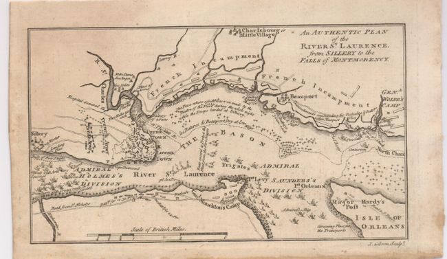
This map details the 1759 "Battle of Quebec" durin... (full text available to subscribers)
Item Detail
 
  MapMaker:  

John Gibson


  Subject:  Canada  
  Period/Size:  1759 / 4.0" x 7.3"  (10.2 x 18.6 cm)  
  Color:  Black & White  
  Condition:  (+B) Very nice impression with original margins. Some toning or foxing at left side. (condition help)  
  Source:  Gentleman's Magazine  
  References:  Jolly (Maps of America) #122; Jolly GENT-137.  
 
 
Sales Information
 
  Price: 

Please register your email to view records, or sign in with email address to see records


  Offered by:  Old World Auctions  
  Catalog:  Auction No. 126 - Antique Maps, Charts, Atlases & Globes (655)  
  Lot/Item #:  109  
 
  Date:  12/2008  


Antique Maps - Valuation and Pricing, Descriptions, Resources


Home | Information | Search | Register | Contact Us | Site Map

Americana Exchange, Inc. © 1999 - 2024 Americana Exchange, Inc.. All rights reserved. OldMaps.com, the OldMaps.com logo and
AMPR are service marks or registered service marks of Americana Exchange, Inc..