| Item Detail |
| |
| |
MapMaker: |
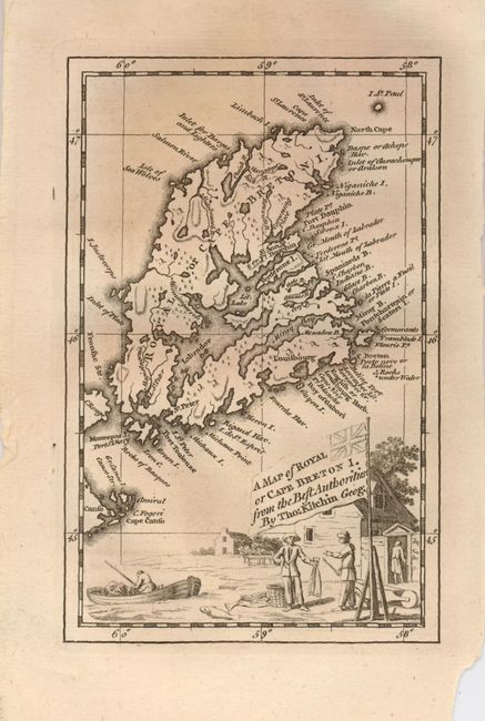
Thomas Kitchin
|
|
| |
| |
Subject: |
Canada, Nova Scotia |
|
| |
Period/Size: |
1747 / 6.4" x 4.0" (16.3 x 10.2 cm)
|
|
| |
Color: |
Black & White
|
|
| |
Condition: |
(+B) Very dark impression on a full sheet with original margins. Lower right corner with small loss well away from map image and plate mark. (condition help) |
|
| |
Source: |
London Magazine |
|
| |
References: |
Jolly LOND-22. |
|
| |
|
|
| Sales Information |
| |
| |
Price: |
|
|
| |
| |
Offered by: |
Old World Auctions |
|
| |
Catalog: |
Auction No. 126 - Antique Maps, Charts, Atlases & Globes (655) |
|
| |
Lot/Item #: |
116 |
|
| |
| |
Date: |
12/2008
|
|
| |
| |
|