| Item Detail |
| |
| |
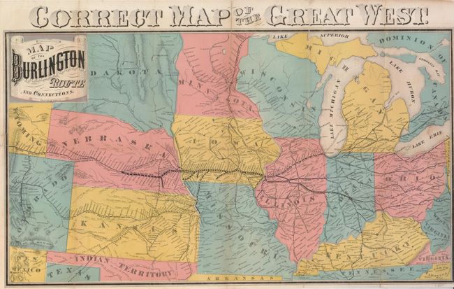
MapMaker: |
Railroad Companies
|
|
| |
| |
Subject: |
United States - Midwest |
|
| |
Period/Size: |
1890 / 13.3" x 23.5" (33.8 x 59.7 cm)
|
|
| |
Color: |
Colored
|
|
| |
Condition: |
(B) Issued folding, now flatted with some folds reinforced with linen and archival mending tape. There are small pencil marks locating some of the western railway stations. A six inch binding tear into the title has been repaired with archival tape. (condition help) |
|
| |
Source: |
|
|
| |
References: |
|
|
| |
|
|
| Sales Information |
| |
| |
Price: |
|
|
| |
| |
Offered by: |
Old World Auctions |
|
| |
Catalog: |
Auction No. 126 - Antique Maps, Charts, Atlases & Globes (655) |
|
| |
Lot/Item #: |
207 |
|
| |
| |
Date: |
12/2008
|
|
| |
| |
|