| Item Detail |
| |
| |
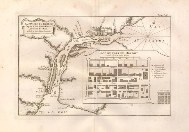
MapMaker: |
Jacques Nicolas Bellin
|
|
| |
| |
Subject: |
Michigan, Detroit |
|
| |
Period/Size: |
1764 / 8.2" x 12.5" (20.9 x 31.8 cm)
|
|
| |
Color: |
Black & White
|
|
| |
Condition: |
(+B) Good impression on a thick sheet of hand laid paper with very wide margins and large watermark. Some marginal foxing with a couple spots rudely entering the map. (condition help) |
|
| |
Source: |
Petite Atlas Maritime |
|
| |
References: |
Tooley (Amer) p. 210 #114; Sellers & Van Ee #777; Karpinski (MI) p.154-5. |
|
| |
|
|
| Sales Information |
| |
| |
Price: |
|
|
| |
| |
Offered by: |
Old World Auctions |
|
| |
Catalog: |
Auction No. 126 - Antique Maps, Charts, Atlases & Globes (655) |
|
| |
Lot/Item #: |
301 |
|
| |
| |
Date: |
12/2008
|
|
| |
| |
|