| Item Detail |
| |
| |
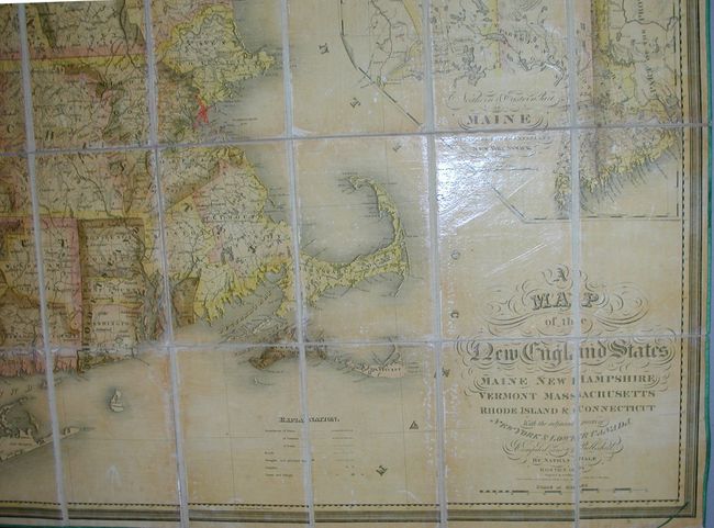
MapMaker: |
Nathan Hale
|
|
| |
| |
Subject: |
New England |
|
| |
Period/Size: |
1826 / 44.0" x 40.0" (111.8 x 101.6 cm)
|
|
| |
Color: |
Colored
|
|
| |
Condition: |
(A) This map is fine, its original varnish is bright with little to no sign of darkening. Most of the original green silk piping is present at map's edge. The slipcase has some wear at edges and corners, and has the original owner's name in ink on front (condition help) |
|
| |
Source: |
|
|
| |
References: |
Phillips (M) p.472; Rumsey #2265 (1827 version). |
|
| |
|
|
| Sales Information |
| |
| |
Price: |
|
|
| |
| |
Offered by: |
Old World Auctions |
|
| |
Catalog: |
Auction No. 126 - Antique Maps, Charts, Atlases & Globes (655) |
|
| |
Lot/Item #: |
165 |
|
| |
| |
Date: |
12/2008
|
|
| |
| |
|