Title:
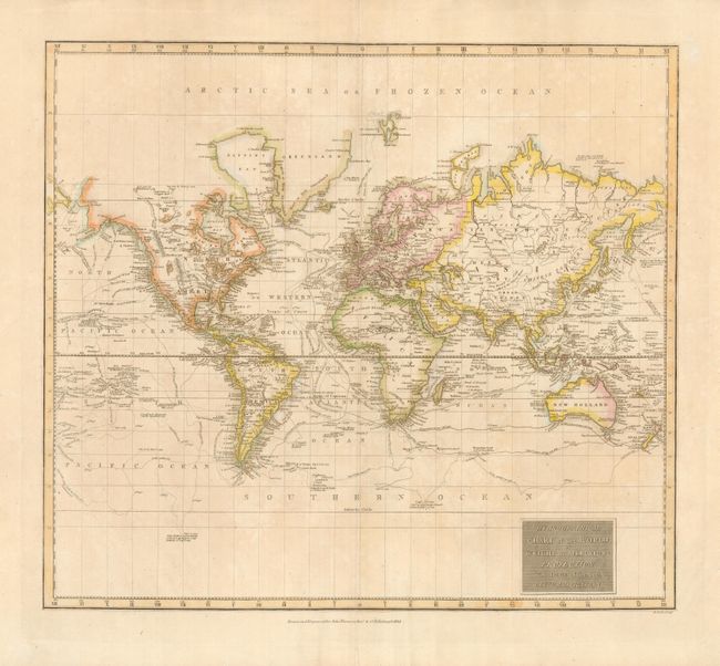
“Hydrographical Chart of the World on Wright or Mercators projection with Tracts of the Last Circumnavigators”
Map Maker:
John Thomson [& Co.]
Handsome chart of the world showing the tracks of ... (full text available to subscribers)
| Item Detail |
| |
| |
MapMaker: |
John Thomson [& Co.]
|
|
| |
| |
Subject: |
World |
|
| |
Period/Size: |
1814 / 17.5" x 19.8" (44.5 x 50.3 cm)
|
|
| |
Color: |
Colored
|
|
| |
Condition: |
(A) Nice original color. There is light uneven toning and a few creases, else fine. (condition help) |
|
| |
Source: |
New General Atlas |
|
| |
References: |
|
|
| |
|
|
| Sales Information |
| |
| |
Price: |
|
|
| |
| |
Offered by: |
Old World Auctions |
|
| |
Catalog: |
Auction No. 126 - Antique Maps, Charts, Atlases & Globes (655) |
|
| |
Lot/Item #: |
036 |
|
| |
| |
Date: |
12/2008
|
|
| |
| |
|
Antique Maps - Valuation and Pricing, Descriptions, Resources |
|
Home |
Information |
Search |
Register |
Contact Us |
Site Map
Americana Exchange, Inc. © 1999 - 2024 Americana Exchange, Inc.. All rights reserved.
OldMaps.com, the OldMaps.com logo and
AMPR are service marks or registered service marks of Americana Exchange, Inc..
|