| Item Detail |
| |
| |
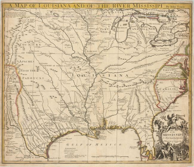
MapMaker: |
John Senex
|
|
| |
| |
Subject: |
Colonial Louisiana, Mississippi River |
|
| |
Period/Size: |
1721 / 19.0" x 22.5" (48.3 x 57.2 cm)
|
|
| |
Color: |
Colored
|
|
| |
Condition: |
(+B) Original color and a good impression. The margins are narrow, but still adequate for framing with toning and some paper restoration at right. (condition help) |
|
| |
Source: |
|
|
| |
References: |
Cumming (SE) #182; Lemmon, Magill & Wiese plt. 21; Wheat (TMW) #100. |
|
| |
|
|
| Sales Information |
| |
| |
Price: |
|
|
| |
| |
Offered by: |
Old World Auctions |
|
| |
Catalog: |
Auction No. 126 - Antique Maps, Charts, Atlases & Globes (655) |
|
| |
Lot/Item #: |
182 |
|
| |
| |
Date: |
12/2008
|
|
| |
| |
|