Title:
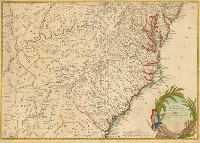
“Partie Meridionale des Possessions Angloise en Amerique, pour Servire d'Intelligence a la Guerre Presente…”
Map Maker:
Verrier & Perrier
This is the rare, southern sheet of a two-part, Fr... (full text available to subscribers)
| Item Detail |
| |
| |
MapMaker: |
Verrier & Perrier
|
|
| |
| |
Subject: |
Colonial Southeast |
|
| |
Period/Size: |
1778 / 20.0" x 28.5" (50.8 x 72.4 cm)
|
|
| |
Color: |
Colored
|
|
| |
Condition: |
(+B) The margins have been trimmed, but are still adequate for framing. There is some minor foxing in the map and a few old paper repairs in the margins. (condition help) |
|
| |
Source: |
|
|
| |
References: |
Sellers & Van Ee #161. |
|
| |
|
|
| Sales Information |
| |
| |
Price: |
|
|
| |
| |
Offered by: |
Old World Auctions |
|
| |
Catalog: |
Auction No. 126 - Antique Maps, Charts, Atlases & Globes (655) |
|
| |
Lot/Item #: |
196 |
|
| |
| |
Date: |
12/2008
|
|
| |
| |
|
Antique Maps - Valuation and Pricing, Descriptions, Resources |
|
Home |
Information |
Search |
Register |
Contact Us |
Site Map
Americana Exchange, Inc. © 1999 - 2024 Americana Exchange, Inc.. All rights reserved.
OldMaps.com, the OldMaps.com logo and
AMPR are service marks or registered service marks of Americana Exchange, Inc..
|