| Item Detail |
| |
| |
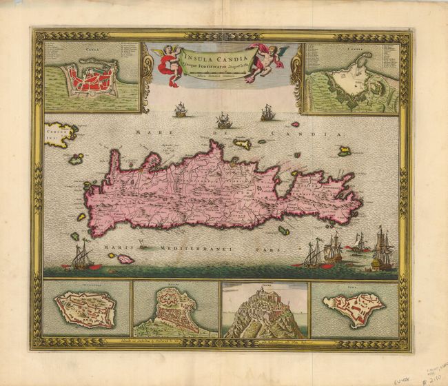
MapMaker: |
Frederick de Wit
|
|
| |
| |
Subject: |
Crete |
|
| |
Period/Size: |
1688 / 17.8" x 21.0" (45.3 x 53.4 cm)
|
|
| |
Color: |
Colored
|
|
| |
Condition: |
(B) Stunning, early impression and a sheet of hand laid paper with very wide margins and fine old hand coloring. A little toning at edges with some roughness two small lines of staining or toning in map below Crete. Clean split on upper centerfold just (condition help) |
|
| |
Source: |
|
|
| |
References: |
Zacharakis, C. #2392. |
|
| |
|
|
| Sales Information |
| |
| |
Price: |
|
|
| |
| |
Offered by: |
Old World Auctions |
|
| |
Catalog: |
Auction No. 127 - Antique Maps, Charts, Atlases & Globes (678) |
|
| |
Lot/Item #: |
666 |
|
| |
| |
Date: |
02/2009
|
|
| |
| |
|