Title:
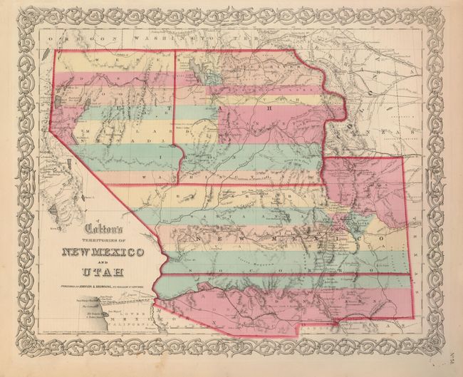
“Colton's Territories of New Mexico and Utah”
Map Maker:
Johnson & Browning
This is the scarce issue of Colton's great map of ... (full text available to subscribers)
| Item Detail |
| |
| |
MapMaker: |
Johnson & Browning
|
|
| |
| |
Subject: |
Southwestern United States |
|
| |
Period/Size: |
1859-60 / 12.8" x 15.6" (32.6 x 39.7 cm)
|
|
| |
Color: |
Colored
|
|
| |
Condition: |
(+B) Exceptionally fine impression and original coloring with wide margins. Small loss at upper margin expertly repaired. One small area of marginal foxing that just enters the border. (condition help) |
|
| |
Source: |
Illustrated Family Atlas |
|
| |
References: |
Brown (Portolan - Spring 2005) pp. 48-51; cf Wheat (TMW) #832. |
|
| |
|
|
| Sales Information |
| |
| |
Price: |
|
|
| |
| |
Offered by: |
Old World Auctions |
|
| |
Catalog: |
Auction No. 127 - Antique Maps, Charts, Atlases & Globes (678) |
|
| |
Lot/Item #: |
247 |
|
| |
| |
Date: |
02/2009
|
|
| |
| |
|
Antique Maps - Valuation and Pricing, Descriptions, Resources |
|
Home |
Information |
Search |
Register |
Contact Us |
Site Map
Americana Exchange, Inc. © 1999 - 2024 Americana Exchange, Inc.. All rights reserved.
OldMaps.com, the OldMaps.com logo and
AMPR are service marks or registered service marks of Americana Exchange, Inc..
|