Title:
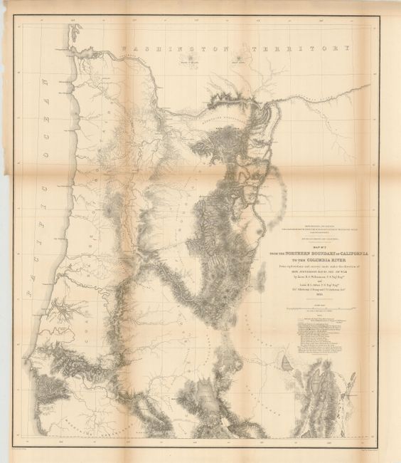
“Map No. 2 from the Northern Boundary of California to the Columbia River from the explorations and surveys made under the direction of Hon. Jefferson Davis, Sec. of War…”
Map Maker:
Williamson & Abbot
From the surveys of Williamson and Abbot, this map... (full text available to subscribers)
| Item Detail |
| |
| |
MapMaker: |
Williamson & Abbot
|
|
| |
| |
Subject: |
Oregon |
|
| |
Period/Size: |
1855 / 27.3" x 23.0" (69.4 x 58.5 cm)
|
|
| |
Color: |
Black & White
|
|
| |
Condition: |
(+C) With some heavy fold toning. Some folds supported on verso with archival tape and one small internal tear also closed on verso. (condition help) |
|
| |
Source: |
U.S. Pacific Railroad Surveys |
|
| |
References: |
Wheat (TMW) #882. |
|
| |
|
|
| Sales Information |
| |
| |
Price: |
|
|
| |
| |
Offered by: |
Old World Auctions |
|
| |
Catalog: |
Auction No. 127 - Antique Maps, Charts, Atlases & Globes (678) |
|
| |
Lot/Item #: |
326 |
|
| |
| |
Date: |
02/2009
|
|
| |
| |
|
Antique Maps - Valuation and Pricing, Descriptions, Resources |
|
Home |
Information |
Search |
Register |
Contact Us |
Site Map
Americana Exchange, Inc. © 1999 - 2024 Americana Exchange, Inc.. All rights reserved.
OldMaps.com, the OldMaps.com logo and
AMPR are service marks or registered service marks of Americana Exchange, Inc..
|