Title:
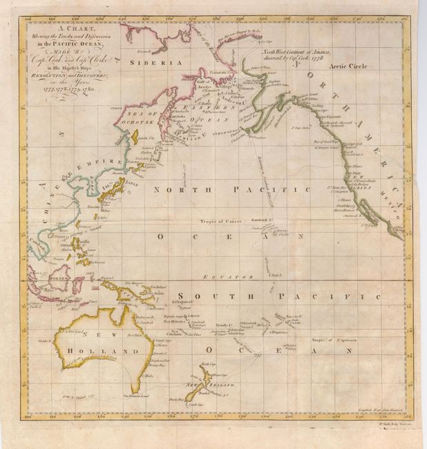
“A Chart, Shewing the Tracks and Discoveries in the Pacific Ocean, Made by Capt. Cook, and Capt. Clerke in his Majesty's Ships Resolution and Discovery, in the Years 1777, 1778, 1779, 1780”
Map Maker:
James Cook
This map covers the whole Pacific and focuses on t... (full text available to subscribers)
| Item Detail |
| |
| |
MapMaker: |
James Cook
|
|
| |
| |
Subject: |
Pacific Ocean |
|
| |
Period/Size: |
1782 / 13.8" x 13.5" (35.1 x 34.3 cm)
|
|
| |
Color: |
Colored
|
|
| |
Condition: |
(B) Issued folding. A 1-1/2" binding tear at right has been repaired. The paper is slightly toned. (condition help) |
|
| |
Source: |
An Authentic Narrative of a Voyage Performed by Captain Cook and Captain Clerke |
|
| |
References: |
Howes #E122. |
|
| |
|
|
| Sales Information |
| |
| |
Price: |
|
|
| |
| |
Offered by: |
Old World Auctions |
|
| |
Catalog: |
Auction No. 127 - Antique Maps, Charts, Atlases & Globes (678) |
|
| |
Lot/Item #: |
783 |
|
| |
| |
Date: |
02/2009
|
|
| |
| |
|
Antique Maps - Valuation and Pricing, Descriptions, Resources |
|
Home |
Information |
Search |
Register |
Contact Us |
Site Map
Americana Exchange, Inc. © 1999 - 2024 Americana Exchange, Inc.. All rights reserved.
OldMaps.com, the OldMaps.com logo and
AMPR are service marks or registered service marks of Americana Exchange, Inc..
|