Title:
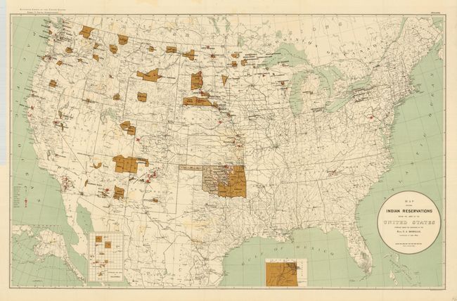
“Map Showing Indian Reservations within the Limits of the United States Compiled under the Direction of the Hon. T.J. Morgan”
Map Maker:
U.S. Government
This over-sized map of the United States focuses o... (full text available to subscribers)
| Item Detail |
| |
| |
MapMaker: |
U.S. Government
|
|
| |
| |
Subject: |
United States |
|
| |
Period/Size: |
1894 / 21.0" x 33.0" (53.4 x 83.9 cm)
|
|
| |
Color: |
Colored
|
|
| |
Condition: |
(A) A nice example that would be fine except for very light offsetting from the darkly colored reservations and a short tear at binding trim. Beautiful impression and coloring on clean paper with original margins. Folding, as issued. (condition help) |
|
| |
Source: |
Report of the Eleventh Census of the United States |
|
| |
References: |
|
|
| |
|
|
| Sales Information |
| |
| |
Price: |
|
|
| |
| |
Offered by: |
Old World Auctions |
|
| |
Catalog: |
Auction No. 127 - Antique Maps, Charts, Atlases & Globes (678) |
|
| |
Lot/Item #: |
167 |
|
| |
| |
Date: |
02/2009
|
|
| |
| |
|
Antique Maps - Valuation and Pricing, Descriptions, Resources |
|
Home |
Information |
Search |
Register |
Contact Us |
Site Map
Americana Exchange, Inc. © 1999 - 2024 Americana Exchange, Inc.. All rights reserved.
OldMaps.com, the OldMaps.com logo and
AMPR are service marks or registered service marks of Americana Exchange, Inc..
|