| Item Detail |
| |
| |
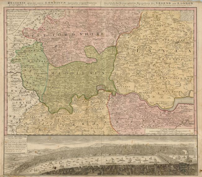
MapMaker: |
Homann Heirs
|
|
| |
| |
Subject: |
England, London |
|
| |
Period/Size: |
1741 / 19.3" x 22.3" (49.1 x 56.7 cm)
|
|
| |
Color: |
Colored
|
|
| |
Condition: |
(B) The original color is slightly faded and there are some light stains in the map. There are two old repairs on verso of the left side, closing a small tear in the border and a hole in the blank margin. There is a 1/2" fold separation at bottom (condition help) |
|
| |
Source: |
|
|
| |
References: |
Howgego #88. |
|
| |
|
|
| Sales Information |
| |
| |
Price: |
|
|
| |
| |
Offered by: |
Old World Auctions |
|
| |
Catalog: |
Auction No. 127 - Antique Maps, Charts, Atlases & Globes (678) |
|
| |
Lot/Item #: |
469 |
|
| |
| |
Date: |
02/2009
|
|
| |
| |
|