Title:
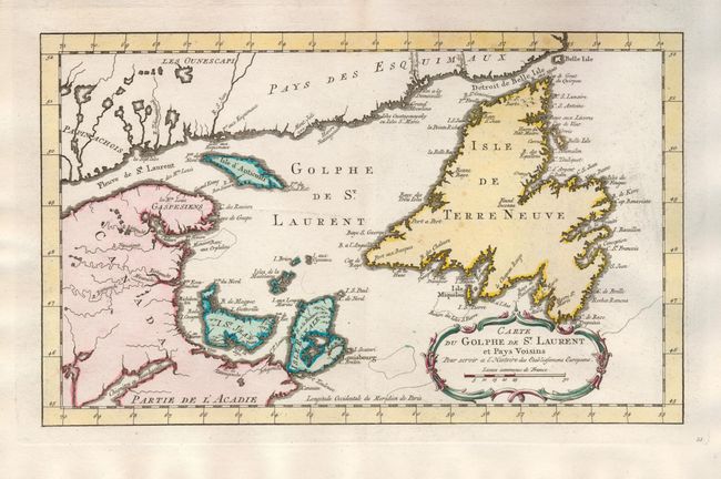
“Carte du Golphe de St. Laurent et Pays Voisins”
Map Maker:
Jacques Nicolas Bellin
This attractive, copper engraved map shows St. Law... (full text available to subscribers)
| Item Detail |
| |
| |
MapMaker: |
Jacques Nicolas Bellin
|
|
| |
| |
Subject: |
Canada |
|
| |
Period/Size: |
1773 / 8.5" x 14.0" (21.6 x 35.6 cm)
|
|
| |
Color: |
Colored
|
|
| |
Condition: |
(A) Sharp impression and original color with a couple very insignificant spots, over all very good. (condition help) |
|
| |
Source: |
Raynal's Atlas Portatif |
|
| |
References: |
Kershaw #592. |
|
| |
|
|
| Sales Information |
| |
| |
Price: |
|
|
| |
| |
Offered by: |
Old World Auctions |
|
| |
Catalog: |
Auction No. 127 - Antique Maps, Charts, Atlases & Globes (678) |
|
| |
Lot/Item #: |
118 |
|
| |
| |
Date: |
02/2009
|
|
| |
| |
|
Antique Maps - Valuation and Pricing, Descriptions, Resources |
|
Home |
Information |
Search |
Register |
Contact Us |
Site Map
Americana Exchange, Inc. © 1999 - 2024 Americana Exchange, Inc.. All rights reserved.
OldMaps.com, the OldMaps.com logo and
AMPR are service marks or registered service marks of Americana Exchange, Inc..
|