Rister or Sign In to see pricing information


Title:

The Gulf of Finland and Baltic Sea with the Fortified Places from Stockholm to St. Petersburg… Designed to Show the Operations of the British & French Fleets

Map Maker:

James Wyld

The Gulf of Finland and Baltic Sea with the Fortified Places from Stockholm to St. Petersburg… Designed to Show the Operations of the British & French Fleets

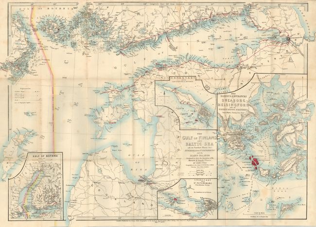
Uncommon pocket map of the Baltic area naming St. ... (full text available to subscribers)
Item Detail
 
  MapMaker:  

James Wyld


  Subject:  Baltic  
  Period/Size:  1855 / 18.8" x 27.0"  (47.8 x 68.6 cm)  
  Color:  Colored  
  Condition:  (+B) Map is very nice with just a couple of light spots. Covers are somewhat rubbed and spine is sunned. Owner's name in ink on blank inside cover, dated 1855. (condition help)  
  Source:   
  References:   
 
 
Sales Information
 
  Price: 

Please register your email to view records, or sign in with email address to see records


  Offered by:  Old World Auctions  
  Catalog:  Auction No. 127 - Antique Maps, Charts, Atlases & Globes (678)  
  Lot/Item #:  496  
 
  Date:  02/2009  


Antique Maps - Valuation and Pricing, Descriptions, Resources


Home | Information | Search | Register | Contact Us | Site Map

Americana Exchange, Inc. © 1999 - 2024 Americana Exchange, Inc.. All rights reserved. OldMaps.com, the OldMaps.com logo and
AMPR are service marks or registered service marks of Americana Exchange, Inc..