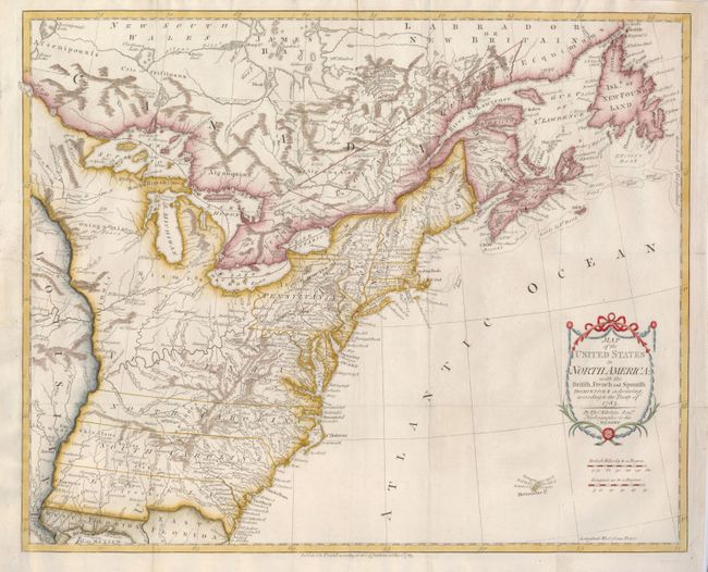
Title:
“Map of the United States in North America: with the British, French and Spanish Dominions adjoining, according to the Treaty of 1783”
Map Maker:
Thomas Kitchin
This is one of the earliest English maps to off... (full text available to subscribers)
| Item Detail |
| |
| |
MapMaker: |
Thomas Kitchin
|
|
| |
| |
Subject: |
Eastern United States and Canada |
|
| |
Period/Size: |
1783 / 16.0" x 20.0" (40.7 x 50.8 cm)
|
|
| |
Color: |
Colored
|
|
| |
Condition: |
(+B) Issued folding, now flattened with paper repairs at fold intersections and paper added to the binding trim. A 2" tear into the map is repaired with tissue on verso. (condition help) |
|
| |
Source: |
|
|
| |
References: |
McCorkle #783-11; Phillips (M) p. 862. |
|
| |
|
|
| Sales Information |
| |
| |
Price: |
|
|
| |
| |
Offered by: |
Old World Auctions |
|
| |
Catalog: |
Auction No. 127 - Antique Maps, Charts, Atlases & Globes (678) |
|
| |
Lot/Item #: |
137 |
|
| |
| |
Date: |
02/2009
|
|
| |
| |
|
Antique Maps - Valuation and Pricing, Descriptions, Resources |
|
Home |
Information |
Search |
Register |
Contact Us |
Site Map
Americana Exchange, Inc. © 1999 - 2024 Americana Exchange, Inc.. All rights reserved.
OldMaps.com, the OldMaps.com logo and
AMPR are service marks or registered service marks of Americana Exchange, Inc..
|