| Item Detail |
| |
| |
MapMaker: |
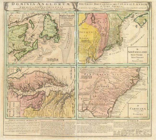
Homann Heirs
|
|
| |
| |
Subject: |
Colonial United States and Canada |
|
| |
Period/Size: |
1740 / 19.8" x 21.8" (50.3 x 55.4 cm)
|
|
| |
Color: |
Colored
|
|
| |
Condition: |
(+C) Slightly faded original color with some uneven toning. There is damage and paper loss along the centerfold that affects the map borders. It has been stabilized with tissue on verso along with a couple of tiny cracks in the map of Newfoundland visib (condition help) |
|
| |
Source: |
|
|
| |
References: |
Cumming (SE) #223; McCorkle #740.1; Portinaro & Knirsch #63; Sellers & Van Ee #83. |
|
| |
|
|
| Sales Information |
| |
| |
Price: |
|
|
| |
| |
Offered by: |
Old World Auctions |
|
| |
Catalog: |
Auction No. 127 - Antique Maps, Charts, Atlases & Globes (678) |
|
| |
Lot/Item #: |
126 |
|
| |
| |
Date: |
02/2009
|
|
| |
| |
|