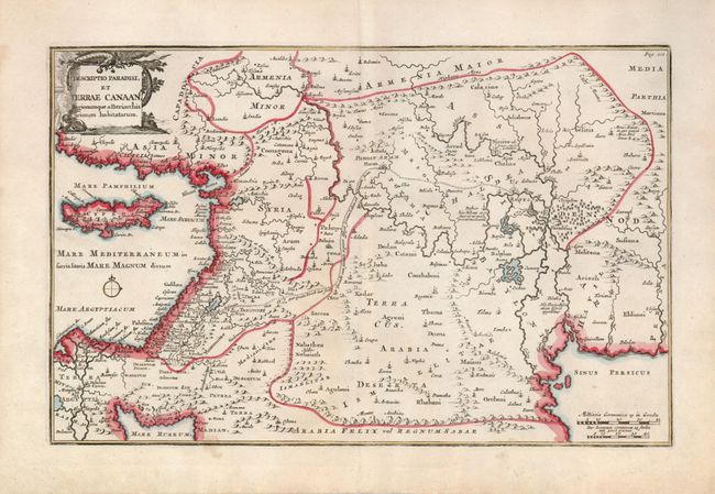
Title:
“Descriptio Paradisi, et Terrae Canaan…”
Map Maker:
Francois Halma
Nice map that displays the Middle East from the ea... (full text available to subscribers)
| Item Detail |
| |
| |
MapMaker: |
Francois Halma
|
|
| |
| |
Subject: |
Holy Land |
|
| |
Period/Size: |
1717 / 8.3" x 13.0" (21.1 x 33.1 cm)
|
|
| |
Color: |
Colored
|
|
| |
Condition: |
(+B) There is a faint spot that just enters the map at bottom, else very good. Linen hinge remnants on verso. (condition help) |
|
| |
Source: |
|
|
| |
References: |
Laor #320; Poortman & Augusteijn #166. |
|
| |
|
|
| Sales Information |
| |
| |
Price: |
|
|
| |
| |
Offered by: |
Old World Auctions |
|
| |
Catalog: |
Auction No. 127 - Antique Maps, Charts, Atlases & Globes (678) |
|
| |
Lot/Item #: |
690 |
|
| |
| |
Date: |
02/2009
|
|
| |
| |
|
Antique Maps - Valuation and Pricing, Descriptions, Resources |
|
Home |
Information |
Search |
Register |
Contact Us |
Site Map
Americana Exchange, Inc. © 1999 - 2024 Americana Exchange, Inc.. All rights reserved.
OldMaps.com, the OldMaps.com logo and
AMPR are service marks or registered service marks of Americana Exchange, Inc..
|