| Item Detail |
| |
| |
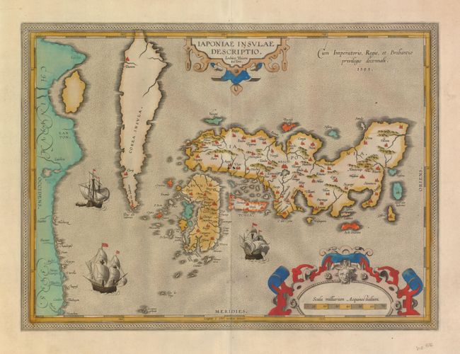
MapMaker: |
Abraham Ortelius
|
|
| |
| |
Subject: |
Japan and Korea |
|
| |
Period/Size: |
1595 / 14.0" x 19.0" (35.6 x 48.3 cm)
|
|
| |
Color: |
Colored
|
|
| |
Condition: |
(A) Fine impression and lovely old color. The map is toned on verso with a few short edge tears, not near the map. (condition help) |
|
| |
Source: |
Theatrum Orbis Terrarum |
|
| |
References: |
Walter OAG #5, plt. 19; Van den Broecke #165. |
|
| |
|
|
| Sales Information |
| |
| |
Price: |
|
|
| |
| |
Offered by: |
Old World Auctions |
|
| |
Catalog: |
Auction No. 127 - Antique Maps, Charts, Atlases & Globes (678) |
|
| |
Lot/Item #: |
719 |
|
| |
| |
Date: |
02/2009
|
|
| |
| |
|