Title:
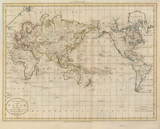
“A Chart of the World, According to Mercators Projection Shewing the latest Discoveries of Capt. Cook”
Map Maker:
William Guthrie
This interesting chart of the world presented on M... (full text available to subscribers)
| Item Detail |
| |
| |
MapMaker: |
William Guthrie
|
|
| |
| |
Subject: |
World |
|
| |
Period/Size: |
1785 / 14.5" x 18.5" (36.9 x 47.0 cm)
|
|
| |
Color: |
Colored
|
|
| |
Condition: |
(+B) A short fold separation at top is closed with archival tape and there is some minor toning and offsetting. There is a blue ink number stamped in the lower margin. (condition help) |
|
| |
Source: |
New System of Geography |
|
| |
References: |
|
|
| |
|
|
| Sales Information |
| |
| |
Price: |
|
|
| |
| |
Offered by: |
Old World Auctions |
|
| |
Catalog: |
Auction No. 128 - Antique Maps, Charts, Atlases & Globes (679) |
|
| |
Lot/Item #: |
048 |
|
| |
| |
Date: |
05/2009
|
|
| |
| |
|
Antique Maps - Valuation and Pricing, Descriptions, Resources |
|
Home |
Information |
Search |
Register |
Contact Us |
Site Map
Americana Exchange, Inc. © 1999 - 2024 Americana Exchange, Inc.. All rights reserved.
OldMaps.com, the OldMaps.com logo and
AMPR are service marks or registered service marks of Americana Exchange, Inc..
|