Title:
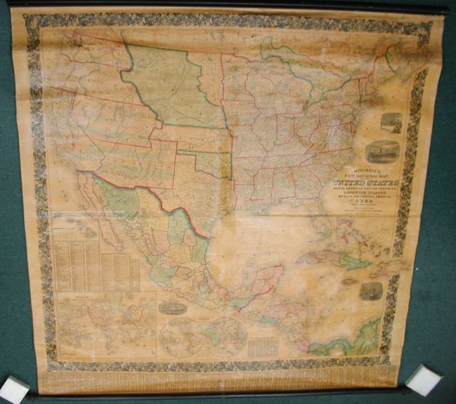
“Mitchell's New National Map Exhibiting the United States with the North American British Provinces, Sandwich Islands, Mexico and Central American, Together with Cuba and other West India Islands.”
Map Maker:
Samuel Augustus Mitchell
This wall map is a beautiful second edition exampl... (full text available to subscribers)
| Item Detail |
| |
| |
MapMaker: |
Samuel Augustus Mitchell
|
|
| |
| |
Subject: |
North America |
|
| |
Period/Size: |
1857 / 63.0" x 63.0" (160.1 x 160.1 cm)
|
|
| |
Color: |
Colored
|
|
| |
Condition: |
(+B) Very good, unrestored condition with bright coloring and strong impression, varnish mostly clear and bright with an overall slight darkening heightening the map's vintage appearance. A little rubbing to varnish in a couple places, a small (1/2") pie (condition help) |
|
| |
Source: |
|
|
| |
References: |
Wheat (TMW) #896; Rumsey #2292. |
|
| |
|
|
| Sales Information |
| |
| |
Price: |
|
|
| |
| |
Offered by: |
Old World Auctions |
|
| |
Catalog: |
Auction No. 128 - Antique Maps, Charts, Atlases & Globes (679) |
|
| |
Lot/Item #: |
140 |
|
| |
| |
Date: |
05/2009
|
|
| |
| |
|
Antique Maps - Valuation and Pricing, Descriptions, Resources |
|
Home |
Information |
Search |
Register |
Contact Us |
Site Map
Americana Exchange, Inc. © 1999 - 2024 Americana Exchange, Inc.. All rights reserved.
OldMaps.com, the OldMaps.com logo and
AMPR are service marks or registered service marks of Americana Exchange, Inc..
|