Title:
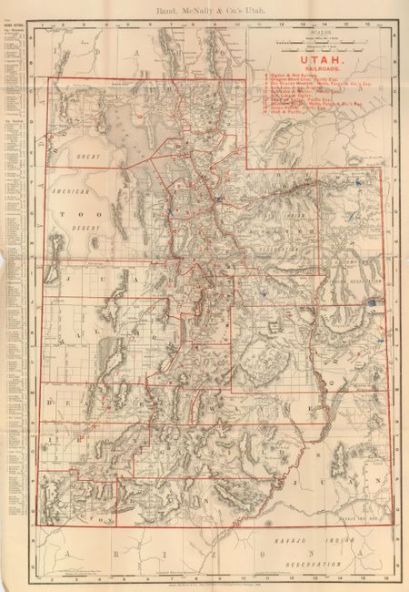
“Rand, McNally & Co.'s Indexed County and Township Pocket Map of Utah...Showing in Detail the Entire Railroad System…”
Map Maker:
Rand, McNally & Co.
This detailed pocket map "Rand McNally & Co.'s Uta... (full text available to subscribers)
| Item Detail |
| |
| |
MapMaker: |
Rand, McNally & Co.
|
|
| |
| |
Subject: |
Utah |
|
| |
Period/Size: |
1899 / 19.0" x 12.5" (48.3 x 31.8 cm)
|
|
| |
Color: |
Colored
|
|
| |
Condition: |
(+B) The map has a few rough areas in margins, one clean fold split at bottom, and a few blue pencil marks on map and is detached from the covers. The covers have an ink name across the top. (condition help) |
|
| |
Source: |
|
|
| |
References: |
|
|
| |
|
|
| Sales Information |
| |
| |
Price: |
|
|
| |
| |
Offered by: |
Old World Auctions |
|
| |
Catalog: |
Auction No. 128 - Antique Maps, Charts, Atlases & Globes (679) |
|
| |
Lot/Item #: |
381 |
|
| |
| |
Date: |
05/2009
|
|
| |
| |
|
Antique Maps - Valuation and Pricing, Descriptions, Resources |
|
Home |
Information |
Search |
Register |
Contact Us |
Site Map
Americana Exchange, Inc. © 1999 - 2024 Americana Exchange, Inc.. All rights reserved.
OldMaps.com, the OldMaps.com logo and
AMPR are service marks or registered service marks of Americana Exchange, Inc..
|