Rister or Sign In to see pricing information


Title:

Coast Chart No. 110 Cape Cod Bay Massachusetts

Map Maker:

U.S. Coast & Geodetic Survey

Coast Chart No. 110 Cape Cod Bay Massachusetts

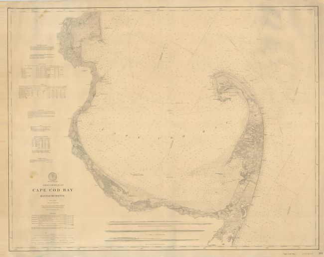
This exceptional sailing chart shows extraordinary... (full text available to subscribers)
Item Detail
 
  MapMaker:  

U.S. Coast & Geodetic Survey


  Subject:  Massachusetts, Cape Cod  
  Period/Size:  1892 / 30.5" x 38.8"  (77.5 x 98.6 cm)  
  Color:  Black & White  
  Condition:  (+B) A couple small spots or smudges on map, some edges a little rough but overall very good. Original linen is fine. (condition help)  
  Source:   
  References:   
 
 
Sales Information
 
  Price: 

Please register your email to view records, or sign in with email address to see records


  Offered by:  Old World Auctions  
  Catalog:  Auction No. 128 - Antique Maps, Charts, Atlases & Globes (679)  
  Lot/Item #:  344  
 
  Date:  05/2009  


Antique Maps - Valuation and Pricing, Descriptions, Resources


Home | Information | Search | Register | Contact Us | Site Map

Americana Exchange, Inc. © 1999 - 2024 Americana Exchange, Inc.. All rights reserved. OldMaps.com, the OldMaps.com logo and
AMPR are service marks or registered service marks of Americana Exchange, Inc..