Title:
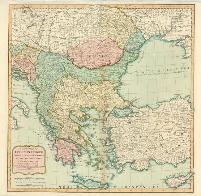
“A New Map of Turkey in Europe Divided into All its Provinces; with the Adjacent Countries in Europe and Asia…”
Map Maker:
Laurie & Whittle
This sharply engraved map is based on information ... (full text available to subscribers)
| Item Detail |
| |
| |
MapMaker: |
Laurie & Whittle
|
|
| |
| |
Subject: |
Balkans, Greece and Turkey |
|
| |
Period/Size: |
1794 / 24.0" x 28.8" (61.0 x 73.2 cm)
|
|
| |
Color: |
Colored
|
|
| |
Condition: |
(B) Good impression and original color. Toned on the centerfold with a short fold separation at bottom and tissue repair on the fold intersection on verso. (condition help) |
|
| |
Source: |
Imperial Sheet Atlas |
|
| |
References: |
|
|
| |
|
|
| Sales Information |
| |
| |
Price: |
|
|
| |
| |
Offered by: |
Old World Auctions |
|
| |
Catalog: |
Auction No. 128 - Antique Maps, Charts, Atlases & Globes (679) |
|
| |
Lot/Item #: |
703 |
|
| |
| |
Date: |
05/2009
|
|
| |
| |
|
Antique Maps - Valuation and Pricing, Descriptions, Resources |
|
Home |
Information |
Search |
Register |
Contact Us |
Site Map
Americana Exchange, Inc. © 1999 - 2024 Americana Exchange, Inc.. All rights reserved.
OldMaps.com, the OldMaps.com logo and
AMPR are service marks or registered service marks of Americana Exchange, Inc..
|