Rister or Sign In to see pricing information


Title:

Insula D. Helenae sacra coeli clementia et aequabilitate…

Map Maker:

Theodore de Bry

Insula D. Helenae sacra coeli clementia et aequabilitate…

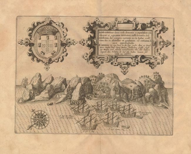
This elaborate profile view shows the small Atlant... (full text available to subscribers)
Item Detail
 
  MapMaker:  

Theodore de Bry


  Subject:  Atlantic, St. Helena  
  Period/Size:  1600 / 8.4" x 11.3"  (21.4 x 28.7 cm)  
  Color:  Black & White  
  Condition:  (+B) Lightly toned with a pair of small worm holes, one of which is in the image (on the island just below the ship at left). (condition help)  
  Source:   
  References:   
 
 
Sales Information
 
  Price: 

Please register your email to view records, or sign in with email address to see records


  Offered by:  Old World Auctions  
  Catalog:  Auction No. 128 - Antique Maps, Charts, Atlases & Globes (679)  
  Lot/Item #:  493  
 
  Date:  05/2009  


Antique Maps - Valuation and Pricing, Descriptions, Resources


Home | Information | Search | Register | Contact Us | Site Map

Americana Exchange, Inc. © 1999 - 2024 Americana Exchange, Inc.. All rights reserved. OldMaps.com, the OldMaps.com logo and
AMPR are service marks or registered service marks of Americana Exchange, Inc..