| Item Detail |
| |
| |
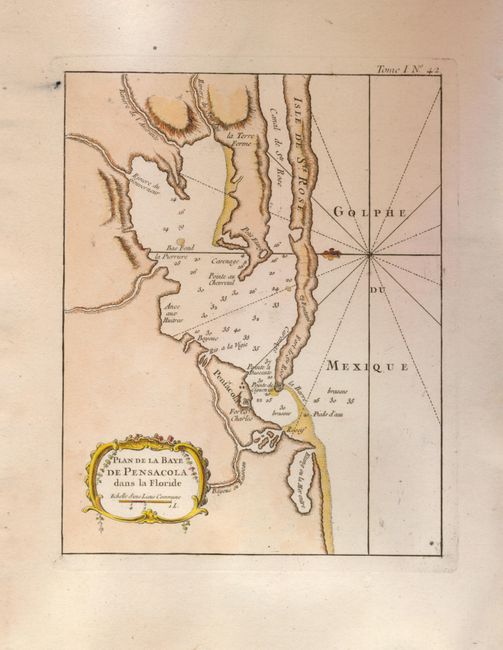
MapMaker: |
Jacques Nicolas Bellin
|
|
| |
| |
Subject: |
Florida |
|
| |
Period/Size: |
1764 / 8.5" x 6.7" (21.6 x 17.1 cm)
|
|
| |
Color: |
Colored
|
|
| |
Condition: |
(A) Fine example with wide margins, crisp impression and fine color less one ink spot with smudge outside map image at upper left. Text watermark. (condition help) |
|
| |
Source: |
Le Petit Atlas Maritime |
|
| |
References: |
Phillips (A) #3508; Sellers & Van Ee #1655. |
|
| |
|
|
| Sales Information |
| |
| |
Price: |
|
|
| |
| |
Offered by: |
Old World Auctions |
|
| |
Catalog: |
Auction No. 128 - Antique Maps, Charts, Atlases & Globes (679) |
|
| |
Lot/Item #: |
315 |
|
| |
| |
Date: |
05/2009
|
|
| |
| |
|