Title:
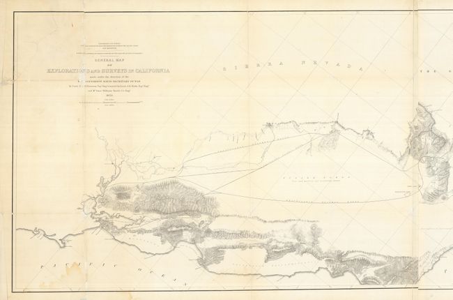
“Routes in California to Connect with the Routes near the 32nd and 35th Parallels. General Map of Explorations and Surveys in California made under the Direction of Hon. Jefferson Davis Secretary of War”
Map Maker:
Robert S. Williamson
Wheat calls this a "monumental document, and is no... (full text available to subscribers)
| Item Detail |
| |
| |
MapMaker: |
Robert S. Williamson
|
|
| |
| |
Subject: |
California |
|
| |
Period/Size: |
1853 / 24.0" x 72.0" (61.0 x 182.9 cm)
|
|
| |
Color: |
Black & White
|
|
| |
Condition: |
(B) A surprisingly clean example without fold toning as normally seen. The map was folding, but is now backed with tissue to support fold splits and some tears including multiple ones in the title area with some infilling. (condition help) |
|
| |
Source: |
U.S. Pacific Railroad Surveys |
|
| |
References: |
Wheat (TMW) #877. |
|
| |
|
|
| Sales Information |
| |
| |
Price: |
|
|
| |
| |
Offered by: |
Old World Auctions |
|
| |
Catalog: |
Auction No. 128 - Antique Maps, Charts, Atlases & Globes (679) |
|
| |
Lot/Item #: |
300 |
|
| |
| |
Date: |
05/2009
|
|
| |
| |
|
Antique Maps - Valuation and Pricing, Descriptions, Resources |
|
Home |
Information |
Search |
Register |
Contact Us |
Site Map
Americana Exchange, Inc. © 1999 - 2024 Americana Exchange, Inc.. All rights reserved.
OldMaps.com, the OldMaps.com logo and
AMPR are service marks or registered service marks of Americana Exchange, Inc..
|