Title:
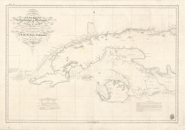
“Carta Esferica de una Parte de la Costa Setentrional y Meridional de la Isla de Cuba desde Punta Icacos y Cayo de Piedras hasta el Cabo San Antonio, con la Isla de Pinos y Cayos Adyacentea…”
Map Maker:
Direccion de Hidrografia
This clear and detailed Spanish map of the western... (full text available to subscribers)
| Item Detail |
| |
| |
MapMaker: |
Direccion de Hidrografia
|
|
| |
| |
Subject: |
Cuba |
|
| |
Period/Size: |
1854 / 23.5" x 34.5" (59.7 x 87.7 cm)
|
|
| |
Color: |
Black & White
|
|
| |
Condition: |
(+B) Generally very clean and good condition for a sea chart, with a few faint spots. There are a few short tears in the blank margins and the centerfold has been professionally reinforced with Japanese tissue. (condition help) |
|
| |
Source: |
|
|
| |
References: |
|
|
| |
|
|
| Sales Information |
| |
| |
Price: |
|
|
| |
| |
Offered by: |
Old World Auctions |
|
| |
Catalog: |
Auction No. 129 - Antique Maps, Charts, Atlases & Globes (680) |
|
| |
Lot/Item #: |
387 |
|
| |
| |
Date: |
09/2009
|
|
| |
| |
|
Antique Maps - Valuation and Pricing, Descriptions, Resources |
|
Home |
Information |
Search |
Register |
Contact Us |
Site Map
Americana Exchange, Inc. © 1999 - 2024 Americana Exchange, Inc.. All rights reserved.
OldMaps.com, the OldMaps.com logo and
AMPR are service marks or registered service marks of Americana Exchange, Inc..
|