| Item Detail |
| |
| |
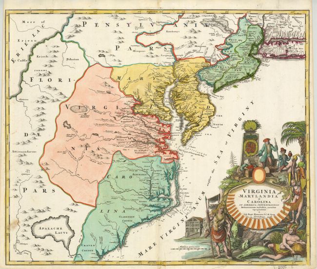
MapMaker: |
Johann Baptist Homann
|
|
| |
| |
Subject: |
Colonial Mid-Atlantic |
|
| |
Period/Size: |
1720 / 19.0" x 22.6" (48.3 x 57.4 cm)
|
|
| |
Color: |
Colored
|
|
| |
Condition: |
(+B) Dark early impression and fine hand coloring with original margins, close at left as usual for this map considering the large plate takes up most of the paper area. Some areas of split along centerfold with repair on verso. One small smudge at lowe (condition help) |
|
| |
Source: |
|
|
| |
References: |
Cumming (SE) #156, Williams & Johnson #7. |
|
| |
|
|
| Sales Information |
| |
| |
Price: |
|
|
| |
| |
Offered by: |
Old World Auctions |
|
| |
Catalog: |
Auction No. 129 - Antique Maps, Charts, Atlases & Globes (680) |
|
| |
Lot/Item #: |
199 |
|
| |
| |
Date: |
09/2009
|
|
| |
| |
|