Title:
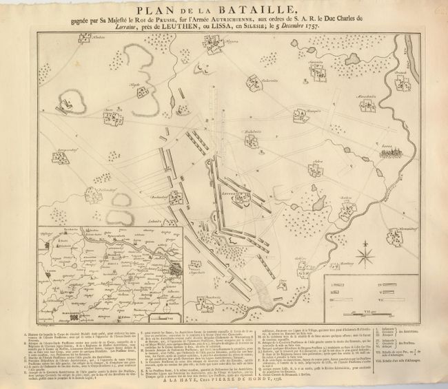
“Plan de la Bataille, gagnee par Sa Majeste le Roi de Prusse, sue l'Armee Autrichienne, aux ordres de S.A.R. le Duc Charles de Lorraine, pres de Leuthen, ou Lissa, en Silesie; le 5 Decembre 1757.”
Map Maker:
Pieter de Hondt
This uncommon plan describes the battle of Leuthen... (full text available to subscribers)
| Item Detail |
| |
| |
MapMaker: |
Pieter de Hondt
|
|
| |
| |
Subject: |
Poland |
|
| |
Period/Size: |
1760 / 12.5" x 16.6" (31.8 x 42.2 cm)
|
|
| |
Color: |
Black & White
|
|
| |
Condition: |
(A) Some soil and rough paper edges, well away from the map. (condition help) |
|
| |
Source: |
|
|
| |
References: |
|
|
| |
|
|
| Sales Information |
| |
| |
Price: |
|
|
| |
| |
Offered by: |
Old World Auctions |
|
| |
Catalog: |
Auction No. 129 - Antique Maps, Charts, Atlases & Globes (680) |
|
| |
Lot/Item #: |
603 |
|
| |
| |
Date: |
09/2009
|
|
| |
| |
|
Antique Maps - Valuation and Pricing, Descriptions, Resources |
|
Home |
Information |
Search |
Register |
Contact Us |
Site Map
Americana Exchange, Inc. © 1999 - 2024 Americana Exchange, Inc.. All rights reserved.
OldMaps.com, the OldMaps.com logo and
AMPR are service marks or registered service marks of Americana Exchange, Inc..
|