| Item Detail |
| |
| |
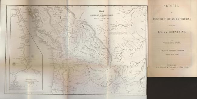
MapMaker: |
Charles Wilkes
|
|
| |
| |
Subject: |
Western Canada and United States |
|
| |
Period/Size: |
1854 / 8.0" x 13.0" (20.4 x 33.1 cm)
|
|
| |
Color: |
Black & White
|
|
| |
Condition: |
(A) The map has some faint, unobtrusive offsetting, and a short extraneous fold in the upper margin. The text pages are generally very clean and bright with an occasional lightly toned areas. The covers are slightly rubbed, the spine and binding are tig (condition help) |
|
| |
Source: |
Astoria or Anecdotes of an Enterprise beyond the Rocky Mountains |
|
| |
References: |
Wheat (TMW) #655; Hayes 199. |
|
| |
|
|
| Sales Information |
| |
| |
Price: |
|
|
| |
| |
Offered by: |
Old World Auctions |
|
| |
Catalog: |
Auction No. 129 - Antique Maps, Charts, Atlases & Globes (680) |
|
| |
Lot/Item #: |
152 |
|
| |
| |
Date: |
09/2009
|
|
| |
| |
|