| Item Detail |
| |
| |
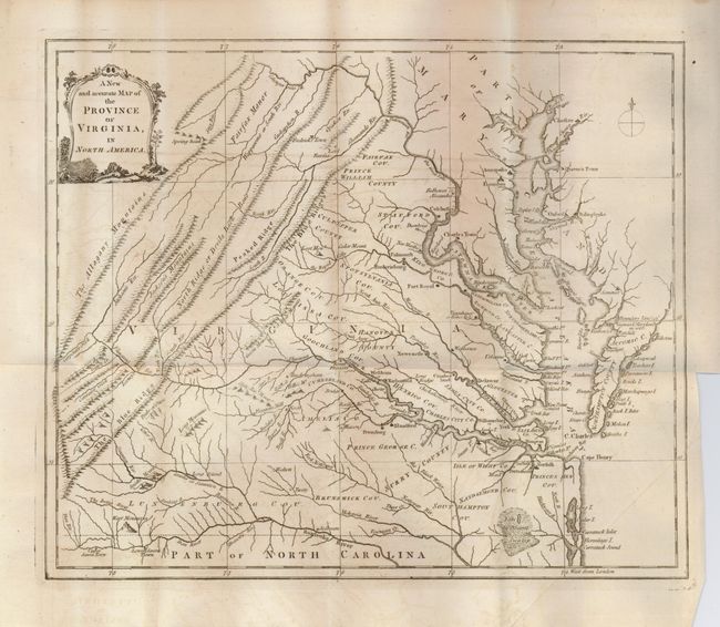
MapMaker: |
Anonymous
|
|
| |
| |
Subject: |
Colonial Virginia |
|
| |
Period/Size: |
1779 / 11.0" x 13.3" (28.0 x 33.8 cm)
|
|
| |
Color: |
Black & White
|
|
| |
Condition: |
(+B) Near fine less some light offsetting. Folding and with binding trim as issued. Printed on thick paper with a fine, large circular watermark. (condition help) |
|
| |
Source: |
Universal Magazine, |
|
| |
References: |
Jolly UNIV-183; Sellers & Van Ee #1444. |
|
| |
|
|
| Sales Information |
| |
| |
Price: |
|
|
| |
| |
Offered by: |
Old World Auctions |
|
| |
Catalog: |
Auction No. 129 - Antique Maps, Charts, Atlases & Globes (680) |
|
| |
Lot/Item #: |
346 |
|
| |
| |
Date: |
09/2009
|
|
| |
| |
|