| Item Detail |
| |
| |
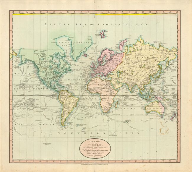
MapMaker: |
John Cary
|
|
| |
| |
Subject: |
World |
|
| |
Period/Size: |
1801 / 17.8" x 20.3" (45.3 x 51.6 cm)
|
|
| |
Color: |
Colored
|
|
| |
Condition: |
(+B) Lovely example with fine, dark impression and full original color and wide margins. There is a small area of flower-pressing stains at lower right and a few very small spots in blank ocean at top. (condition help) |
|
| |
Source: |
Universal Atlas |
|
| |
References: |
Rumsey 1657.003. Phillips (A) 714; The Map Collector, issue 43, p. 40-47. |
|
| |
|
|
| Sales Information |
| |
| |
Price: |
|
|
| |
| |
Offered by: |
Old World Auctions |
|
| |
Catalog: |
Auction No. 129 - Antique Maps, Charts, Atlases & Globes (680) |
|
| |
Lot/Item #: |
041 |
|
| |
| |
Date: |
09/2009
|
|
| |
| |
|